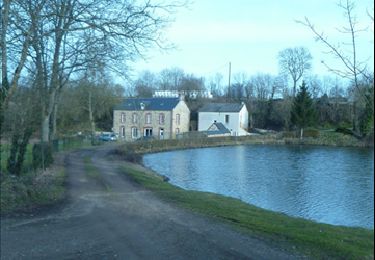
17,1 km | 23 km-effort
Hamars
Roulland
Gebruiker
Lengte
21 km
Max. hoogte
267 m
Positief hoogteverschil
582 m
Km-Effort
29 km
Min. hoogte
29 m
Negatief hoogteverschil
586 m
Boucle
Ja
Datum van aanmaak :
2019-11-29 08:58:24.039
Laatste wijziging :
2019-11-29 14:32:10.228
4h21
Moeilijkheid : Medium
Gratisgps-wandelapplicatie
Over ons
Tocht Stappen van 21 km beschikbaar op Normandië, Calvados, Le Hom. Deze tocht wordt voorgesteld door Roulland.
Plaatsbepaling
Land:
France
Regio :
Normandië
Departement/Provincie :
Calvados
Gemeente :
Le Hom
Locatie:
Hamars
Vertrek:(Dec)
Vertrek:(UTM)
679426 ; 5430269 (30U) N.
Opmerkingen
Wandeltochten in de omgeving
mt pincon trois monts
Stappen
Moeilijk
Les Monts d'Aunay,
Normandië,
Calvados,
France
29 km | 36 km-effort
6h 0min
Neen
le pont Hom (boucle)
Stappen
Medium
(1)
Le Hom,
Normandië,
Calvados,
France
12,1 km | 16 km-effort
2h 45min
Ja
ouffi
Stappen
Moeilijk
(1)
Ouffières,
Normandië,
Calvados,
France
10 km | 12,7 km-effort
2h 34min
Ja
vtt thury circuit 5
Mountainbike
Moeilijk
Le Hom,
Normandië,
Calvados,
France
30 km | 39 km-effort
3h 3min
Ja
Tour de la Suisse Normande - officiel
Mountainbike
Zeer moeilijk
Le Hom,
Normandië,
Calvados,
France
117 km | 151 km-effort
12h 0min
Ja
goupilliere
Stappen
Gemakkelijk
Montillières-sur-Orne,
Normandië,
Calvados,
France
4 km | 5,3 km-effort
1h 55min
Ja
Thury Harcourt Clécy etape 1
Stappen
Zeer moeilijk
(1)
Le Hom,
Normandië,
Calvados,
France
17 km | 24 km-effort
5h 20min
Neen
boucle tannerie
Stappen
Medium
Le Hom,
Normandië,
Calvados,
France
5,9 km | 8,4 km-effort
1h 55min
Ja